The Federative Republic of Brazil has a land area of 8.5 million km2 and a population of over 214 million. Fig.1 shows the specific location.
There are two mainstreams in our work. One stream generates urban mask products and the second stream generates tree canopy products.
Urban tree canopy mapping dataset and Urban mask mapping dataset
In this study, we used the same semi-supervised learning framework to train two CNN models for urban tree and mask segmentation, respectively. We use Deeplabv3+ (Chen et al., 2018) as our segmentation network. A standard binary classification network was designed as the discriminator in this semi-supervised adversarial learning framework. The pytorch code of this work is available from UTB_master
Urban Tree segmentation results
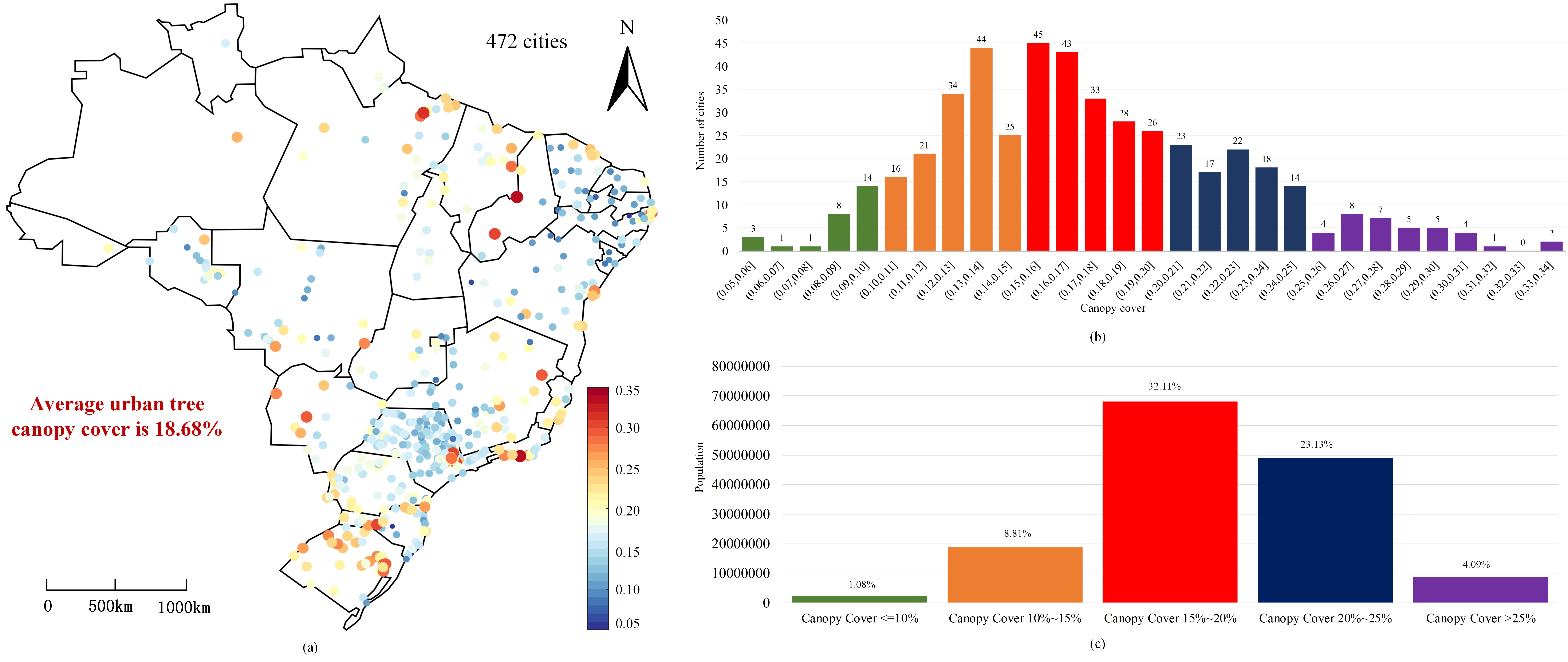
The created urban tree canopy products covering 472 cities in Brazil are available to the community (UTB dataset). This dataset include 26 states of Brazil (also includ Brasília).
E-mail: jianhua.guo@tum.de